
Browse Items (3886 total)
Sort by:
"Kirchen" Arie

Solo Piece for Cornet and Piano
aus Stradella, by bearb. Von Ad. Stiegler
aus Stradella, by bearb. Von Ad. Stiegler
"Largo" Aria

Solo for Cornet and Piano
by G.F. Handel in Kompositionen und Ubertragungen fur cornet A Pistons
by G.F. Handel in Kompositionen und Ubertragungen fur cornet A Pistons
"Liberty Prepares for Grand Return"
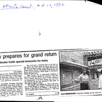
Scan of Atlanta Journal-Constitution article highlighting The Owlettes' Liberty Theater restoration project, spearheaded by Charlotte Frazier, which eventually led to the Liberty's 1997 reopening.
"Marat/Sade" Rehearsal

Students rehearsing for the play "Marat/Sade". David Fortuna and D. Arnold Powell carry Bruce Greging on their shoulders.
MC5 Box1 M F31
MC5 Box1 M F31
"Marble King" Game Instructions, c. 1950s
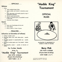
Instructions to the game "Marble King"
"My Lodging's on the cold Ground" and "Gaily the Troubadour"

Solo Pieces
Popular Airs in Cornet and Piano
Popular Airs in Cornet and Piano
"Oh Dad, Poor Dad"

Unidentified Columbus College students performing "Oh Dad, Poor Dad".
MC5 Box1 M F30
MC5 Box1 M F30
"Royal Crown Cola" Poem by D.R. Pippin of Dothan, Alabama. 1947
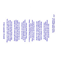
A poem written by D.R. Pippin of Dothan, Alabama that was published in "Nehi News", 1947
"Save the Liberty Theatre" Grand Reopening Ceremony
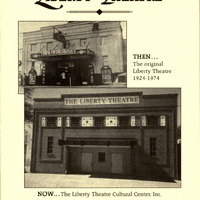
Front cover of booklet advertising The Liberty Theatre's 1997 reopening
"Stone and Concrete Foundation from the Standpoint of Efficiency and Economy," by George C. Warren, 1916
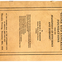
A booklet written by George C. Warren discussing the types of pavements needed under specific conditions.
"Swedish Coronation March," "Parade of the Tin Soldiers," "Los Torros (from la Feria),"

Quartet
by Svendsen, Jessel, P. Lacome,
by Svendsen, Jessel, P. Lacome,
"Taste-Test" Results, 1938-1939
Results gathered from the taste-tests conducted by R.C. Cola from 1938-1939
"The House of Blue Leaves"

Three unidentified students in Columbus College's production of "The House of the Blue Leaves"
MC5 Box1 M F29
MC5 Box1 M F29

"The Robin Sings in the Apple Tree," "Thy Beaming Eyes," "Bay State Commandry," "Polonaise in D Major," "Ballet Music from 'Rosamunde'"

Quartet
by MacDowell, Schubert, W. P. Burrell, and Beethoven
by MacDowell, Schubert, W. P. Burrell, and Beethoven
"Trade Sign"

Round sign with a red and black diamond and spiral motif in the center. It read: " Pasaquan- Afro- American- Indian- Nature- Corporative" around the perimeter, just inside a scalloped aluminum edging. Label on reverse from previous exhibit at the…
"Untitled"

Woman with red bow and blue shirt set within an interior bedroom scene. Nails protrude from all four outward edges.
"What's in a Name" Nehi Information Booklet
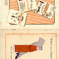
A booklet used to give to stockholders that details the company's assets.
"Who's Afraid of Virginia Wolf"

L-R: Sandy Linver and Chris Abbattisti rehearse for the play "Who's Afraid of Virginia Wolf"
"X" Doesn't Mark the Spot

Train Station Burger King on Manchester Expressway marking off their tables to encourage physical distancing. Covid-19 Pandemic.