
3. Old Federal Road
Two Federal Roads connected eastern Georgia with rapidly developing western settlements and supported regional trade, expansion and communications. The southern portion of Georgia’s Federal Roads transected Marion County and would eventually connect Fort Wilkinson, near Milledgeville, Georgia and Pensacola, Florida.
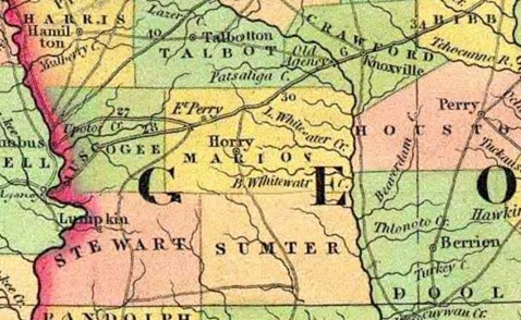
Marion County, 1834. Source: H.S. Tanner, Map of United States of America.
Identified by a faint line on this 1834 map, the Federal Road was originally a Lower Creek trading path. Botanist William Bartram took this trail in 1774. When the Creeks signed the Treaty of Washington in 1805, they gave the US government rights to develop a “horse path” to support more efficient mail delivery between the nation’s capital and New Orleans, Louisiana. The horse path was eventually enlarged from 15 to 24 feet wide and dotted with several forts to protect this vital route. The Federal Road continued to serve migrants, traders, and their wagons. After its opening in 1827, it would become the primary access point for new settlers arriving in Marion County. The Federal Road was used until its role was superseded by railroads in the late 1830s.
Submission composed by Jazmine Kindred, April 20, 2016.
References and Further Reading
Haynes, J. “Federal Road.” New Georgia Encyclopedia, 30 March. Ownby, T. and Wharton, D. 2006 “Phase I: Development of Historical Context for the Federal Road in North Georgia.” The Center for the Study of Southern Culture. 2006.